
|
# |
Content |
Target Function |
Overview |
|---|---|---|---|
|
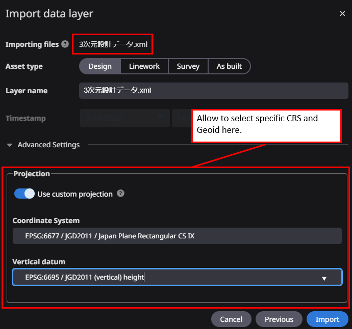
1 |
New feature |
Data Layer |
When registering LandXML or CSV files as survey data, theCRS of the point cloud can now be set to any value.
Allow specifying any projection when registering LandXML or CSV files.
|
|
2 |
Bug Fix |
Data Layer |
After visiting projects and using them for a while, a browser rendering error could occur. This has been fixed so that the site can be displayed correctly. |
|
3 |
Bug Fix |
Measurement |
When user show line annotations on survey data, a portion of the line was sometimes displayed on the bottom of the survey data. This has been corrected so that the line annotations can be displayed correctly. |