|
# |
Content |
Target Function |
Overview |
|---|---|---|---|
|
1 |
Enhancements |
Data layers |
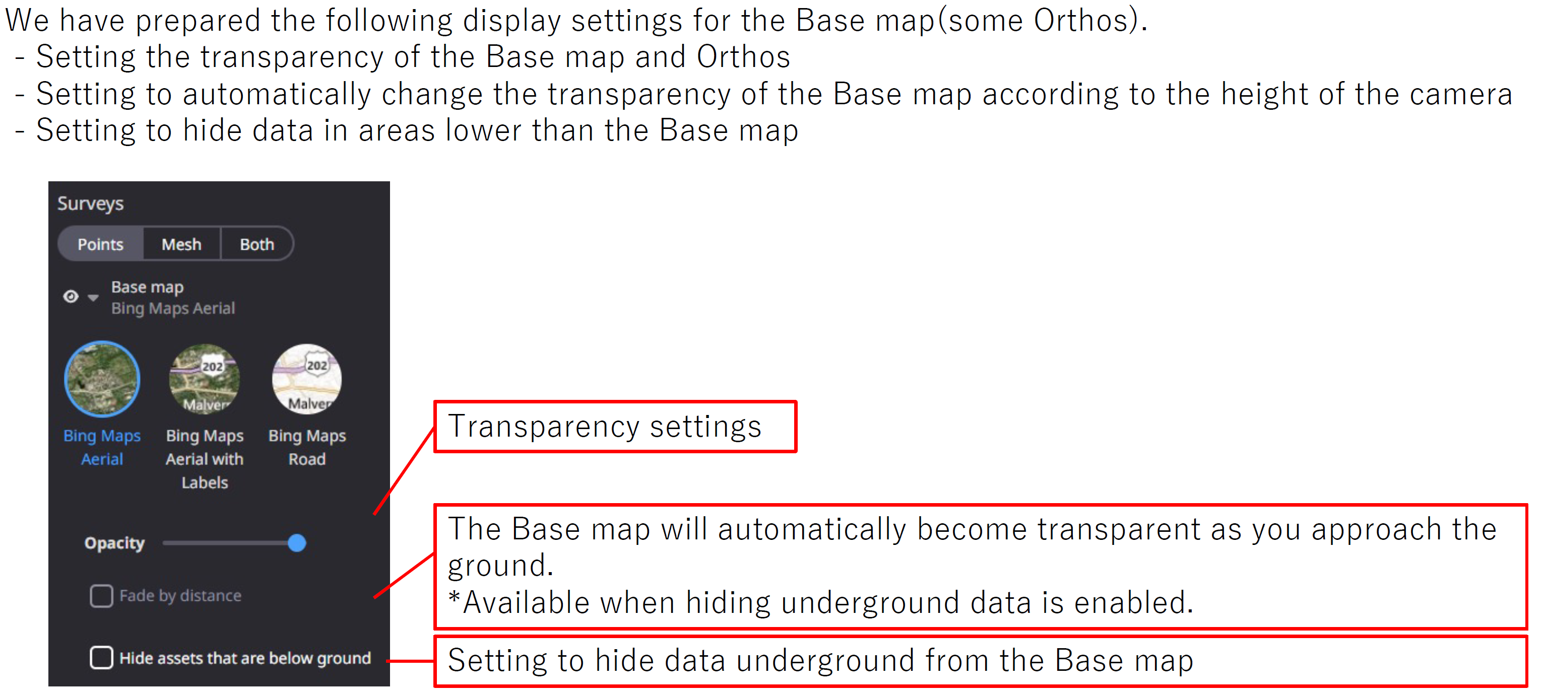
Following display settings are prepared in order to check various data in detail on the 3D map.
|
|
2 |
Enhancements |
Data layers |
User can put design file into folders and manage them in groups. It is easy for a user to switch the show/hide even in projects that uses many design files. 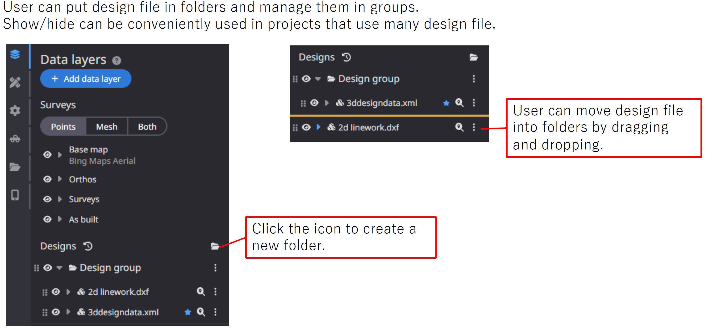
|
|
3 |
Enhancements |
Measurement |
The 2D Cross Section function can now display the difference in height when two or more datasets are displayed. 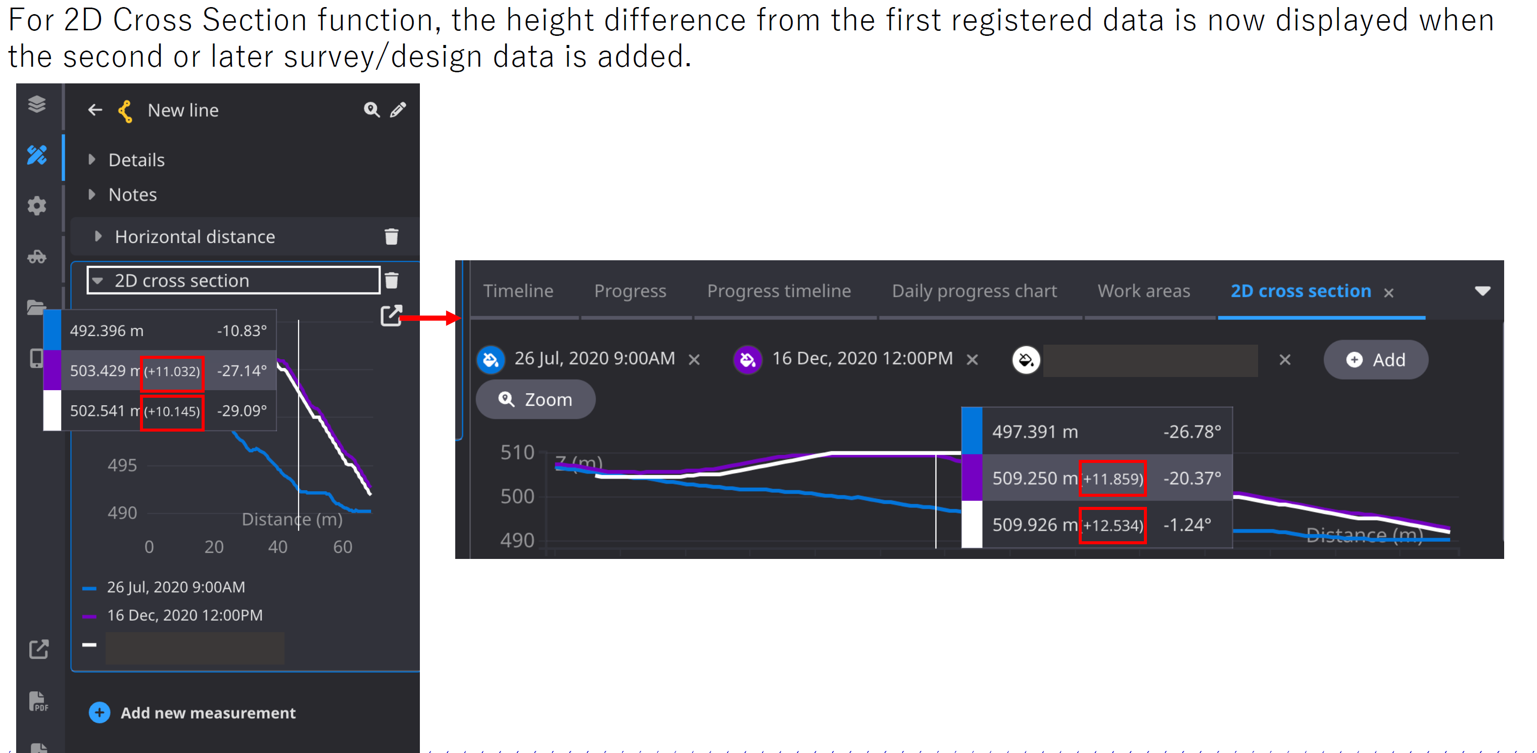
|
|
4 |
Bug fixes |
Data Layers |
When displaying Surveys(Cut and fill), the cost related to the fill data was sometimes not
|
|
5 |
Bug fixes |
Data Layers |
When displaying/hiding each dataset, the line work was sometimes pasted to the appropriate Data layers and not displayed. Fixed so that it is displayed properly. |
|
6 |
Bug fixes |
Data Layers |
When surveying Cut and fill using a design file that specifies Vertical offset , the heat map may not be displayed correctly. Fixed the heatmap to correctly reflect the Vertical offset. |
|
7 |
Bug fixes |
PDF Report |
The following bugs have been fixed in the PDF report creation function.
|
|
8 |
Bug fixes |
|
When uploading a file to the project file, if the file name was 100 characters or more, it might not
|
