|
# |
Type |
Description |
Overview |
|---|---|---|---|
|
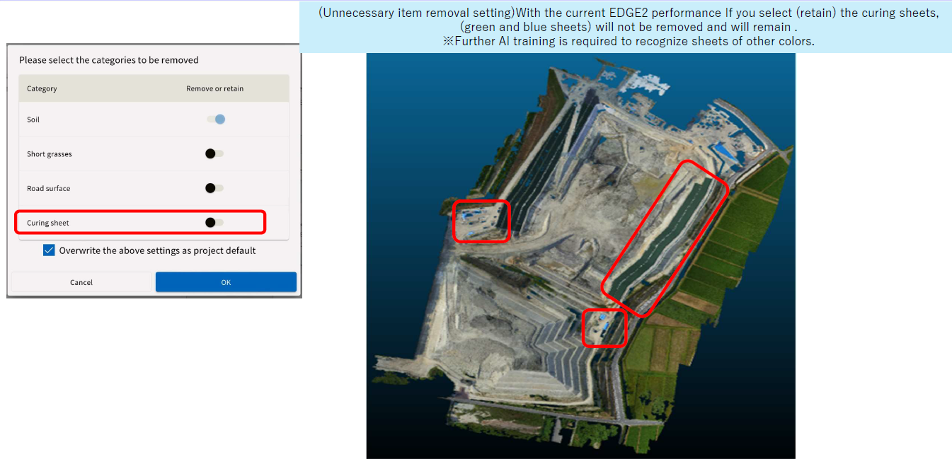
1 |
New feature |
Improved object removal
|
Added a setting to remove/retain
|
|
2 |
New feature |
Flight map display |
Photo overlap 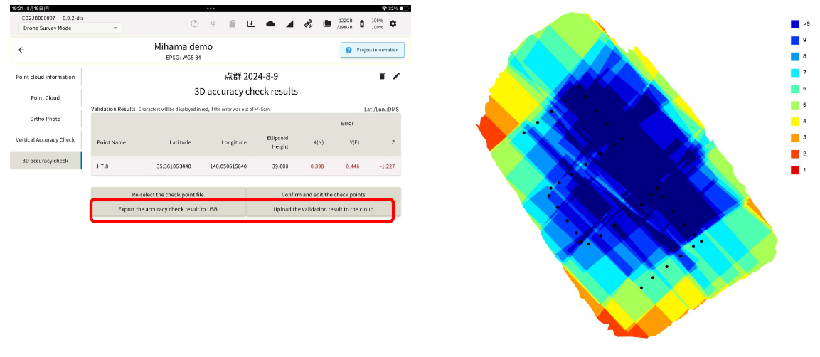
The Dark Blue areas 9-10 indicate sufficient overlap of photos for SfM software to match features for best results. |
|
3 |
New feature |
Point cloud density output of
|
Added a mode with a point cloud
|
|
4 |
New feature |
3D accuracy check csv and
|
3 D Accuracy can now be done by selecting the nearest point to the center of the GCP. Keep in mind that the accuracy check will provide E,N,Z error based on the point and not the actual picture. |
|
5 |
New feature |
Ability to make the top surface of
|
Edge2 setup location can now be
|
|
6 |
Performance Improvement |
Improved accuracy in untextured
|
By improving SFM performance
|
|
7 |
Performance Improvement |
PCG94 compatible (for Australia) |
Support for new EPSG codes |
