10th Dec 2025 - V10.5.3

#

Type

Description

Overview

1

New Feature

Download Mount Point List

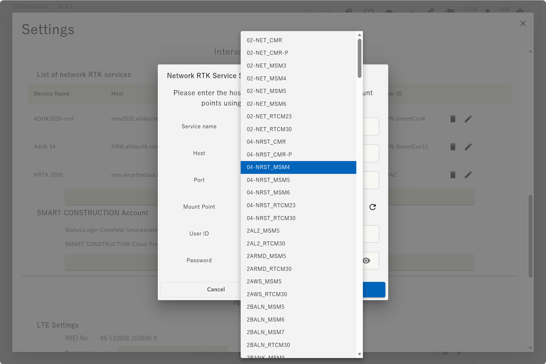
In the Edge2 settings screen, specifying the mount point for the network RTK service has changed from manual entry to a download-based method.
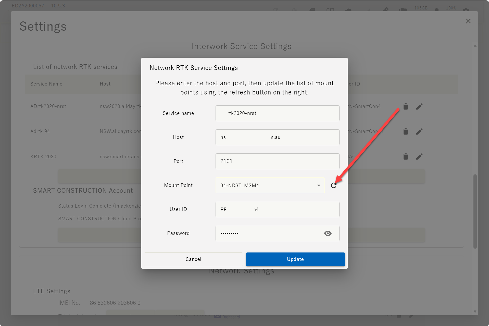
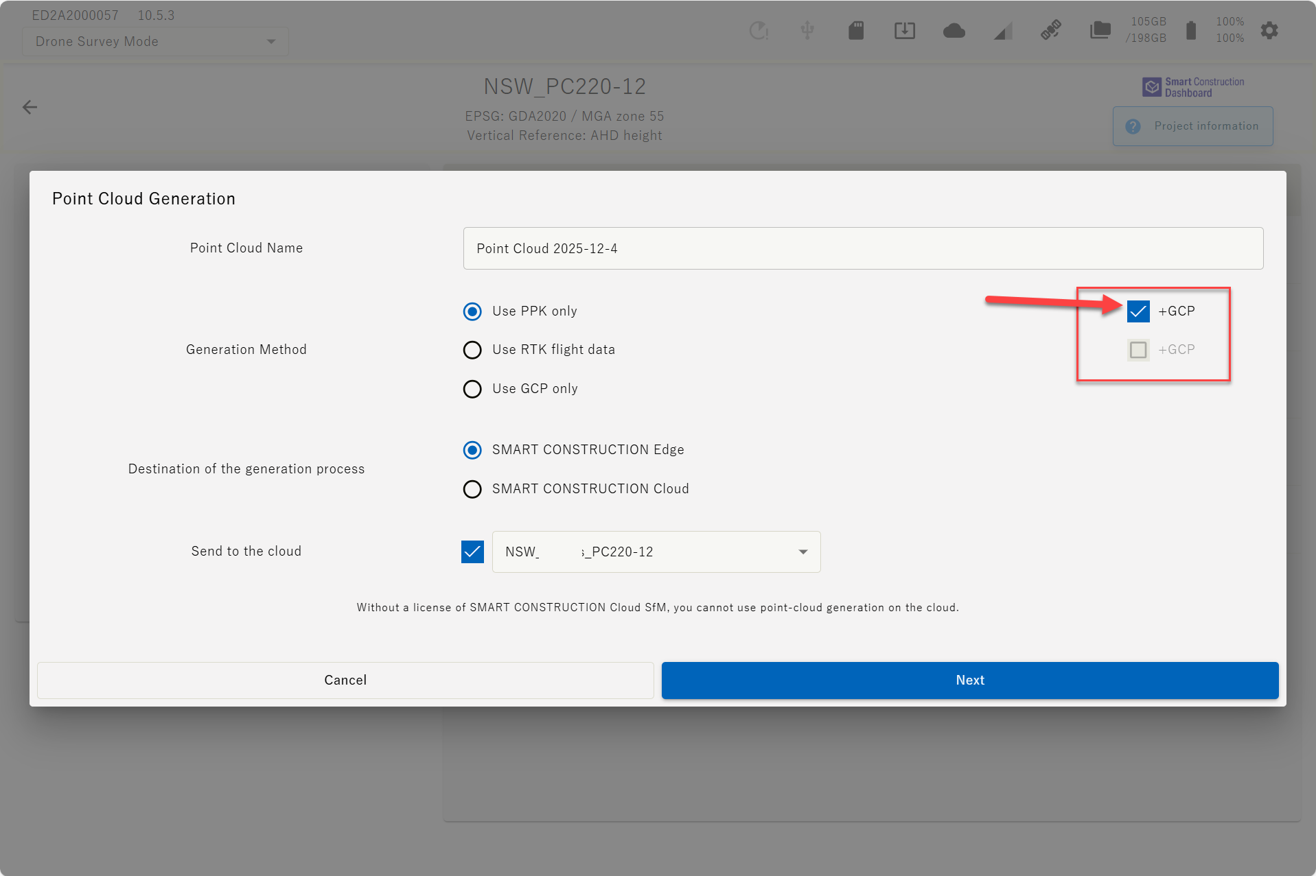
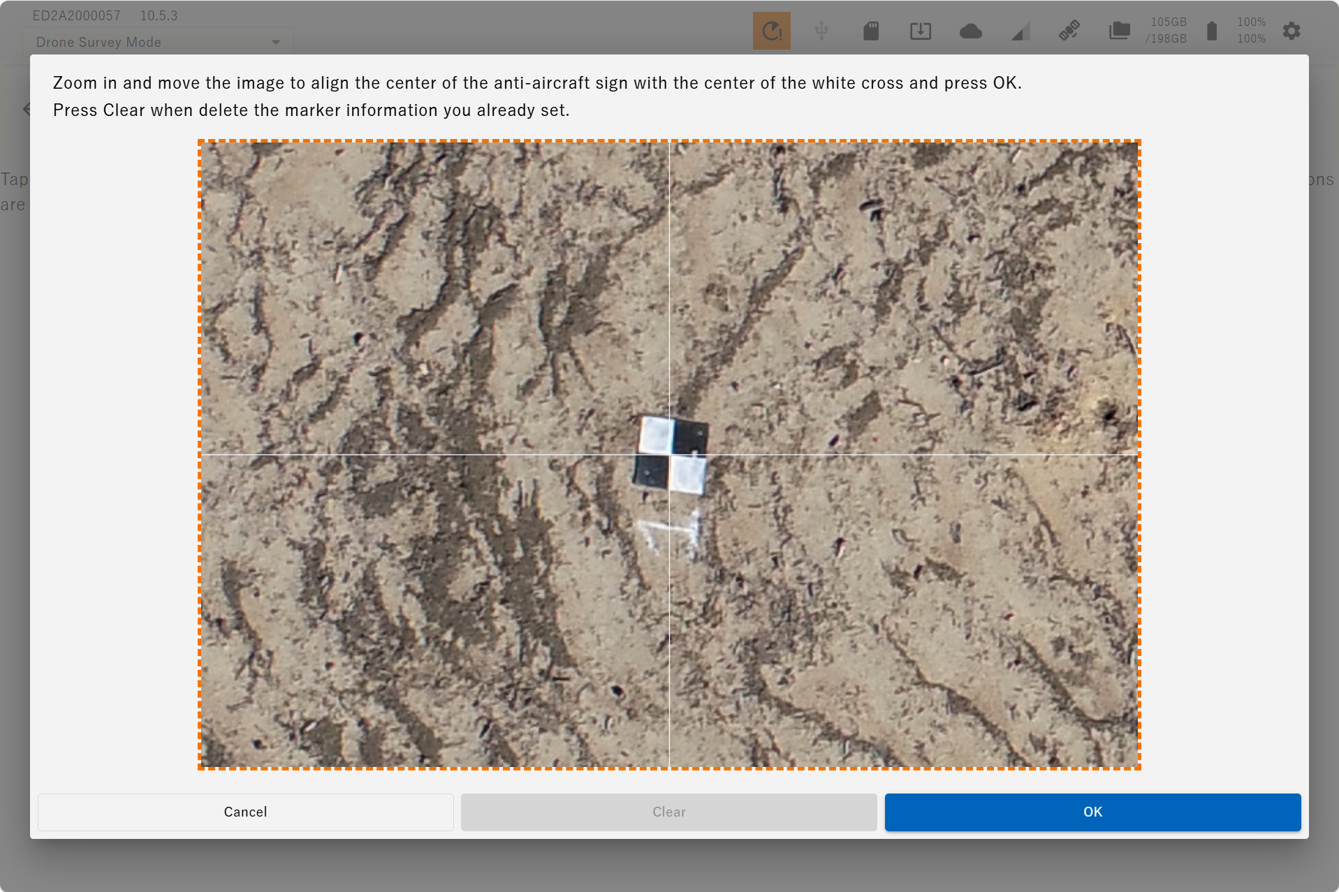
image-20251204-005357.png
image-20251204-005406.png


2

New Feature

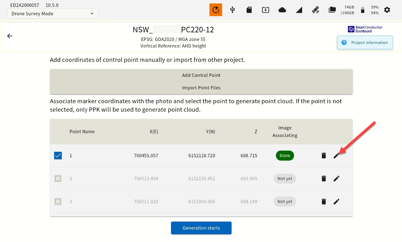
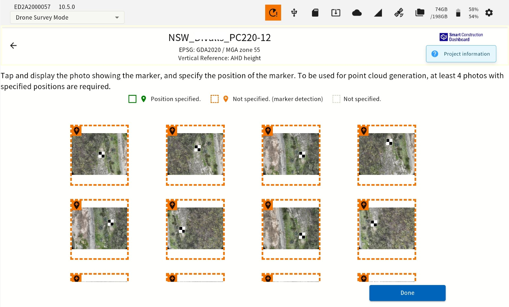
GCP tagging improvement AI

We introduced an AI feature that automatically detects the center of certain GCP markers during SFM processing with aerial target markers (GCP).

During the GCP annotation, GCPs which is close to the coordinates entered will be automatically detected as shown below, and photos of the detected markers will be highlighted in orange.

  1. Tick on +GCP’s

image-20251204-005948.png
  1. After importing the GCPs, start GCP AI detection and tagging confirmation.

    image-20251204-010002.png
  2. Select an image with an orange box.

    8d4c8614-c805-44b9-9bd5-aa1888df61d5.png

    The AI snaps automatically to the target's centre.

    image-20251204-011439.png

    Press “OK” to accept. Tag more than five GCPs; tagging all images improves data accuracy.


image-20251204-011439.png


image-20251204-010149.png
GCP Tagged
image-20251204-010205.png
GCP Detected. Need Confirmation
image-20251204-010240.png
GCP Not detected


Important Information

image-20251204-010625.png
GCP Detectable


image-20251204-010539.png
GCP Not Detectable


3

Improvement

Support a new drone

DJI MATRICE400(Zenmuse P1)

Using DJI M400( with P1 Camera) achieved +/- 5cm level accuracy.
https://enterprise.dji.com/jp/matrice-400

Use the same Camera and drone settings as for Mavic3E & Matrice 4E. Different shutter speed may need to be set for the P1 camera

4

Improvement

SFM performance improvement

SFM performance (Improve the quality of the point cloud) and DTM quality Improvement (lower noise )

5

Bug Fix


  • We have fixed an issue where correction data could not be stopped after being distributed when an external wireless device was not connected.

  • We have modified the input screen for known points to display the units.

  • Fixed a bug where point cloud generation with GCP failed under certain specific conditions.

  • Improvement of the GCP annotation UI: The cross mark was adjusted to make it easier to identify the GCP center (this was addressed because in some cases, accuracy deteriorated when using GCP due to this issue).

  • The problem of SFM processing, when merging multiple flight data from DJI M4E, was fixed

  • The SC account authentication error remains even after recovered from offline.